Tag Archives: Malaysia GIS

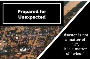
Disaster Response Mapping Program – Being Prepared for Unexpected

is-not-a-matter-of-if-it-is-a-matter-of-when

Few pictures showing flooded roads and trapped cars in East Coast caught my attention this morning. It was reported, tens of thousands of flood victims taking temporary shelter at evacuation centers amidst this unusually late monsoon session that brings heavy rainfall.

A few years ago, I met up with Chris McIntosh, head of Esri Disaster Response Program and Industry Manager for Disaster/Emergency Management based in Redlands, California. He has a lot of experience in applying advanced geospatial technology to issues faced by the public safety community.

He taught me a very valuable lesson I reckon is worth repeating and sharing. Speaking from his experience, he says “we cannot predict when emergency strikes, but we can choose to be prepared”. From information management perspective, being prepared means having ready access to information products that can be disseminated to commander, rescuers from multi-agencies with meaningful map products (both hard and softcopy) anywhere, anytime, on any devices.

This normally involved having necessary hardware, software, data, workflow and capability before disaster strikes in order to response agilely and rapidly to emergency situations. This can be in the form of drills or exercises involving multiple relevant agencies in coordinating, sharing and producing meaningful information products in the events of emergency. Post-mortem discussion to refine our shortcomings in improving coordination, data quality, workflow and technical capability surely will make us more ready when unfortunate situation strikes. We can’t really create times, but being prepared allows us to shorten our response time which in turn means more time to save valuable lives and properties.

We do not need repeated disasters to remind us of our shortcomings. Let’s be prepared before next disaster strikes again. This is not a matter of “if”, it is a matter of “when”.

Chris is absolutely right, we can’t predict the timing of unexpected, but we can choose to be prepared.

This writer hopes there will be a Disaster Response Mapping Program at national level in Malaysia that will able to render quick respond services support to those involve in disaster/emergency management.

Geo-Mentors in Malaysia

I first came across Geographical Information System (GIS) during my early day in University Technology of Malaysia (UTM). I am fortunate to have been a student of late Prof. Dr. Ahris Yaakup from Department of Urban and Regional Planning, Faculty of Built Environment (FAB). The late Prof. Dr. Ahris is among the pioneer GIS lecturer in Malaysia and always passionate to share his knowledge in GIS with his students.

In addition to the late Prof. Dr. Ahris, I am lucky to have another mentor – Mr. Yong Sun Yong (my senior in Town Planning) as my guiding star during my student days in UTM. Both of them take great efforts to show me the fascinating world of GIS, answer my curiosities about what’s possible and recommend reading materials that helped strengthen my understanding about this technology.

My heartfelt appreciation and gratitude to these great gentlemen. I wouldn’t able be where I am today without the support and guidance I got from these geo-mentors.

We definitely need more geo-mentor to promote GIS literacy to our younger generation and for betterment of our society. I am ready to make steps to push this geo-mentor initiative across Malaysia, are you with me?

To both my geo-mentors, thanks for everything and I will continue to make you proud.

Malaysia Budget 2014: My Wish List from Geospatial Perspective

Budget 2014

Malaysia Prime Minister and Finance Minister Datuk Seri Najib Tun Razak will table the 2014 budget in Parliament today. Here are some of my wish list from geospatial perspective:-

A.      On Better Governance and Transparency

  1. Greater Transparency from GIS perspective: Strengthen monitoring of the distribution and use of all allocated funds by setting up an online geospatial map and executive dashboard showing budget allocation and progress by location.
  2. Safer Malaysia and better law enforcement from GIS perspective: to combat rising crime, enforcement agencies need to be equipped with intelligence-led policing system that can pro-actively preventing and resolving crimes by enabling effective data fusion/ intelligence analysis for both crime and investigation analysis
  3. More affordable homes from GIS perspective:  In effort to tackle speculative property prices and provide more affordable housing – government can promote greater transparency by setting up an online geospatial portal showing  data on the transaction prices of properties in easy to visualize intelligence web map that support location analytics and accessible by public through their smartphones, tablets or web browsers.
  4. Better public transport from GIS perspective: Improve land transport integration by setting up a geospatial system that has all land transport networks i.e. roads, pedestrian, LRT, rail, special motorcycle lanes, etc. with necessary details for integrated planning and improvement

B.      On Strengthening Public Sectors

  1. Set up National Geospatial Council consists of key personnel from government sectors and under purview of Prime Minister department or Ministry of Finance  to spearhead data sharing and collaboration among government agencies
  2. Assign at least one (1) Geospatial Information Officer responsible to plan and manage geospatial data in all government agencies
  3. Allocation to support continuous geospatial literacy enhancement training for civil servants in all government sectors in view of the rapid technology advancement in software, infrastructure and hardware components
  4. Allocation to hire or appoint industry subject matter experts that are well verse in geospatial knowledge to work in agencies (i.e. MaCGDI, MAMPU, PEMANDU, PM Dept, MoF, etc) that can shape the policy and direction for local geospatial industry
  5. More allocation for better maintenance of Geospatial IT systems at both federal and state levels
  6. Sufficient funds be set aside for state government to set up (for those State that have yet to have GIS Unit) and maintain state geospatial/GIS unit (for those state with existing GIS Unit)

C.      On Strengthening Private Sectors

  1. Unlocking economic value through open data and information sharing by allowing free access of web services to meaningful/accurate/timely/up-to-date/large-scale/non-sensitive/nationwide basemap and  imagery through intelligent web GIS technology
  2. Include Geospatial and IT as part of program under the 1MET (1Malaysia Entrepreneurship Program) to promote more knowledge economy and job creation

D.      On Strengthening Educational Sectors

  1. Allocation to support inclusion of geodesign and geospatial information technology education in the education sectors (tertiary, secondary and primary level) in line with government’s aims to enhance STEM (Science, Technology, Engineering, Mathematics) education because GIS is STEM.

Malaysia Special Achievement in GIS (SAG) Award Winner

Every year Esri honours organizations that have used GIS to make a difference and improve our community. Nomination for this SAG award started with careful selection by Esri Staff from thousands of organizations worldwide, then personally reviewed and selected by Jack Dangermond, the President and Founder of Esri. The SAG Award ceremony is held at the annual Esri International User Conference in San Diego and presided over by Roger Tomlinson (widely known as Father of GIS) and Jack.

Last year, Safe City Monitoring System (SCMS) from Federal Department of Town and Country Planning, Ministry of Housing and Local Government, Malaysia won the SAG Award Winner for Malaysia. Safe City Monitoring System (SCMS) was developed under an ArcGIS Server Enterprise platform. It is a Web Based Crime Mapping GIS, a work collaboration between Federal Department of Town and Country Planning (JPBD), Royal Malaysian Police (PDRM); and UGISP Sdn Bhd. Police Reporting System (PRS), which has a wide network to major police stations in Malaysia, has been integrated with SCMS, which enables major police stations to facilitate crime location input in digital map form by complainer report. Coordinates and attributes are sent to the SCMS server for crime pattern analysis and statistics using GIS. SCMS is a national effort administered by JPBD. Via Internet, SCMS has helped PDRM and municipal councils to monitor or identify crime locations, which guides allocation of funds (lighting & CCTVs) and human resources (police enforcement, strategic location police presence, community awareness and initiatives) in a joint effort to reduce crime.

For more information about the project, please visit the coverage report in Asia Pacific Futuregov publication here. SAG 2012 - Malaysia

This year, Land and Survey Information System (LASIS) of Sarawak Land and Survey Department won the SAG 2013 award and make Malaysia proud. Development and implementation of LASIS involves three main organizations namely :-

  • Land and Survey Department of Sarawak as the system owner;
  • Information & Communications Technology Unit (ICTU) for funding, standards, policies, and regulations governing State IT implementations;
  • Sarawak Information Systems Sdn. Bhd. (SAINS) as the developer and implementer.

LASIS is a GIS-centric land management solution with a single interface and a modular architecture that allows flexibility in implementation based on ArcGIS technology. Land and Survey Department in Sarawak uses this system to maintain up-to-date records of over 935,000 land parcels, providing fast, accurate and easily accessible information to more than 3,000 direct users and serving over 2.5 million Sarawakians with title extracts, maps and statistical reports. LASIS successfully shorten the land title registration process from 30-90 days to 1 day registration with on-line land applications process and instant land title search

Asia Pacific Futuregov publication has the following coverage report about Land and Survey Sarawak and LASIS project with more details.

www.esri.com/events/user-conference

Using Map to Tell a Story

When I was one of the panel judges for National Geomatic/ Geoinformatics Students Innovation Competition (NGGSIC) organized by universities in Malaysia last year, I am amazed by the creativity of our university students in producing high quality maps that tell specific stories. One that really captured my attention was a historical map detailing all the major battles and incidents took place during World War II (WWII) in Malaysia (back then was Malaya). The students make use of maps to pinpoint location of major battles between Japanese and Alliance forces, substantiated with captions they retrieved from historical literature sources. It was presented with such an interesting and creative manner, as if it was a mindmap of WWII story on a map.

You too can create a mindmap of your story by using a map. Today, making and sharing your story map become much easier, thanks to advancement in computing and geospatial technology. You don’t have to confine yourself with printed, static map to share your information geographically. You can use your desktop GIS to perform map mash up, publish it as web map, to be discovered or consumed on any internet browsers or mobile devices. You have the option to share it internally within your group, or publicly with everyone, just how you normally do it on Facebook.

Yes, in fact story map is indeed Facebook of map.  Story maps combine intelligent web maps with web applications to inform, and share about a wide variety of topics. Maps allow us to communicate wealth of information and present it in easy to understand format. This is the true power of maps.

Take for example in a typical planning approval meeting at local authority level. Town planner normally needs to present development plan application to planning committee for approval. The planner will able to present the story by sharing the location of the development site, information about the planned development, and substantiate with plot ratio map, land-use zoning map to determine the regulatory compliance. In addition, other existing land-use i.e. infrastructure, amenities, public facilities can be overlay to present the story about potential social economic impact to the surrounding areas. The meeting will be more informed and productive when the information above are presented on maps instead of textual or description form.

If you are interested, there are many ready-made templates that can get you started without any programming needed. Esri has large collection of story map gallery to showcase interesting and important topics; to explore techniques and best practices for map-based storytelling; and to help enable people to make their own story maps. For more information about story map, please visit Esri story maps gallery or click on the image below.

Story map

Story telling with maps – A gallery of Esri story maps

So why wait? Let us start using maps to tell story.