Few pictures showing flooded roads and trapped cars in East Coast caught my attention this morning. It was reported, tens of thousands of flood victims taking temporary shelter at evacuation centers amidst this unusually late monsoon session that brings heavy rainfall.
A few years ago, I met up with Chris McIntosh, head of Esri Disaster Response Program and Industry Manager for Disaster/Emergency Management based in Redlands, California. He has a lot of experience in applying advanced geospatial technology to issues faced by the public safety community.
He taught me a very valuable lesson I reckon is worth repeating and sharing. Speaking from his experience, he says “we cannot predict when emergency strikes, but we can choose to be prepared”. From information management perspective, being prepared means having ready access to information products that can be disseminated to commander, rescuers from multi-agencies with meaningful map products (both hard and softcopy) anywhere, anytime, on any devices.
This normally involved having necessary hardware, software, data, workflow and capability before disaster strikes in order to response agilely and rapidly to emergency situations. This can be in the form of drills or exercises involving multiple relevant agencies in coordinating, sharing and producing meaningful information products in the events of emergency. Post-mortem discussion to refine our shortcomings in improving coordination, data quality, workflow and technical capability surely will make us more ready when unfortunate situation strikes. We can’t really create times, but being prepared allows us to shorten our response time which in turn means more time to save valuable lives and properties.
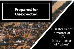
We do not need repeated disasters to remind us of our shortcomings. Let’s be prepared before next disaster strikes again. This is not a matter of “if”, it is a matter of “when”.
Chris is absolutely right, we can’t predict the timing of unexpected, but we can choose to be prepared.
This writer hopes there will be a Disaster Response Mapping Program at national level in Malaysia that will able to render quick respond services support to those involve in disaster/emergency management.