Monthly Archives: February 2013

Cheap,Good,Fast – What’s the True Cost of Your GIS Project ?

True Cost of Your Solution

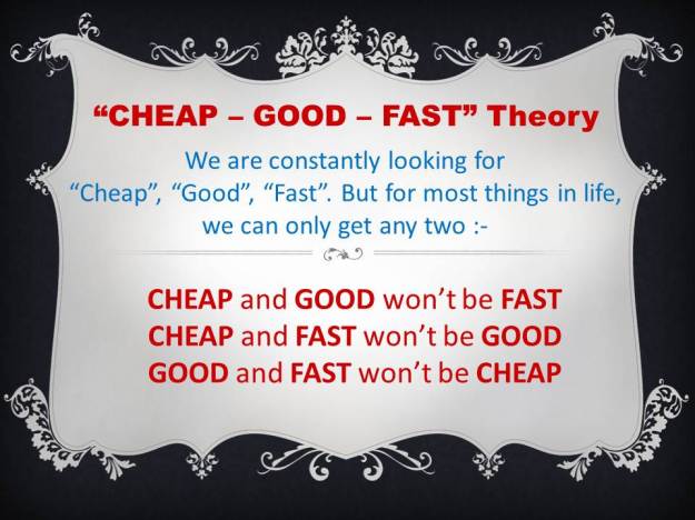
A good friend of mine shares an interesting theory about “cheap”, “good”, “fast”.  According to him, dissatisfaction in life is caused by our pursuant for “cheap”, “good”, “fast” all at once but in most cases, we can only fulfil 2 out of these 3 criteria at any single time. We can find many of these examples in our life and it is understandably very frustrating. Take for example:-

  • We might able to get “cheap” bargain, “good” product but might take times to find this type of deal (not fast).
  • Or we can find “good” products and can get it up and running “fast”, but might cost us some money (not cheap).
  • Or we might able to get “cheap” bargain and available immediately (fast) but turn out it is a substandard product (not good).

While we should constantly pursuing perfection in life, however focusing too much on finding all these three elements is countered productive and will distracting us from solving the fundamental problem – either to reduce our cost (if you are  a cost centre) or increase our revenue (if you are a profit centre).

If you are entrusted your company to find solution to reduce current operation cost or increase revenue, I reckon finding something “good” and in shortest time (fast) is your top priority because every moment of delay means the company is incurring more operation cost or earning lesser revenue. This is especially true if the saving or profit from the new solution can be substantially larger than the cost of acquiring the new solutions. In other word, we should evaluate the cost of the new solutions by taking into consideration what is the potential saving or extra revenue it might generate, rather than merely looking at its face value. In other word, a product that cost you more can become a more viable and cheaper solution, because the saving or extra revenue it generates will outweight its acquisition cost.

In contrary, a cheaper product that doesn’t save you a penny or bring in any extra dollar is considered more expensive in this equation. Hence, our noble intention of looking for cheaper solution need to include all cost parameters into equation instead of focusing on single cost factor – product acquisition cost.

For apple to apple comparison, the cost factors need to include software licenses, development, documentation (system manual, training material), training, maintenance, help desk support, R&D for continuous upgrade & improvement, potential lost in saving, potential revenue lost, as well as cost related to deployment risk (the higher the risk, you might want to factor in higher cost), etc.

After you have figured out all the cost factors, then you will realize cheap or expensive is indeed relatively subjective in this case if you are not comparing apple to apple. Hence value is a better indicator than cost of the product (cheap or expensive) in our quest for solution that can help reduce our operating cost or increase our profitability.

GIS Implementation Strategy – Lesson from Low Cost Carriers

640px-Air_Asia_Boeing_737-300_Malaysian_Flag_MRD

Low-cost carrier’s (LCC) chief element strategy is to fly large numbers of passengers on high frequency, short hops at bargain fares. LCC is able to serve this low-cost segment in the most efficient and economical way by providing fast turnaround time on the ground, standardize all of its planes to lower the cost of training, maintenance and inventory. LCC also opting for reliable, large aircraft manufacturers that offer range of aircrafts with different seating capacity model without ending up with collection of aircrafts from different manufacturers.

It makes a lot of business sense, else you will have to have different crews/hanger/tools to maintain/ stow/fly different aircrafts, different sets of training facilities, as well as different ground infrastructures needed to stow the aircrafts. Worst of all different aircrafts might have different operating procedures and might not able to integrate with each other.

In GIS implementation it is also important to consider the scalability of the GIS software in your implementation, else you would end up having Fokker/McDonnell Douglas in one department, and Airbus/Boeing in another department when you scale up your GIS implementation i.e. after your GIS application is gaining more popularity. Over the longer run, maintaining different incompatible software systems will make your maintenance cost shooting through the root. Worst of all, these different GIS software might not able to integrate well with each other and you are not able to standardize the workflow to maximize your ROI.

It is quite typical that GIS project started with desktop GIS level by a group of specialists to support a single department’s needs i.e. to support simple mapping application and to perform competitive analysis for marketing department. Soon other departments would like to leverage on the capabilities to perform planned or unplanned maintenance works; to track asset inventory; to extend it to customer care officers so that they are aware of the service availability when dealing with customer inquiry and the field crew would probably like to be able to see the accurate network diagram in the field and update the work order once the job is completed, etc. The desktop GIS that first started at marketing department soon need to be upgraded to enterprise GIS with server GIS and mobile GIS capabilities.

As per lesson learned from low-cost carrier, rightfully the last thing you would want to do is to end up having different software system for desktop, server, field and mobile environment that’s not compatible with each other. If you are the CIO or CTO of your organization that has on-going or about to get started with GIS implementation, you might want to do your stakeholders a favour by asking why on earth we are not following the proven business wisdom from low-cost carrier. It is quite understandable that departmental managers only look after their own needs, but as “C” level executives of an organization, it is our responsibility to look at bigger picture and interest of the company as totality.

If software is only good at desktop level but not scalable to meet your next server, mobile and enterprise GIS requirements, is it worth your on-going investment (which involves software, hardware, data, training, etc.)?

GIS can be a hobby but it will be a very costly hobby if you start to collect different type of non-compatible GIS software in your organization.