Walgreens GIS Implementation: Empowerment in Change Management

Implementing GIS requires more than technology. Properly empowering your GIS team is equally crucial in a successful implementation.

There are always many lesson learned and new inspiration from watching GIS use cases and podcast interview with geospatial leaders. Today, I would like to share with you this wonderful use case of applying GIS in commercial world for staying ahead of competitions, improving collaboration among various departments and ultimately growing sales and profitability.

Walgreens is US’s second-largest pharmacy store chain with about 8000 stores nationwide. Walgreens is leveraging on GIS extensively to improve information feed supporting marketing planning, sales, media relation and even M&A due diligence. You can watch the full video here

Walgreens is using GIS to help them understand their customers better by putting on spatial lens to get better answer for their spatial questions such as where they live, where they work, what they shop from which stores, etc.

Walgreens is collating their sales data from their stores that spread all over US to identify trends and patterns. One example shared in the video is how Walgreen invented their own almost real time Flu-Index by aggregating all flu-related prescriptions sold nationwide with powerful mapping analytic capability. Instead of relying on official Flu-Index data which are normally few weeks lagged, this near real time Flu-Index enable Walgreens to know flu outbreak ahead and to react earlier.

However, what really attracted my attention and worth highlighting is the video starts with Director of Enterprise Location Intelligence explaining the GIS team is well-positioned within Corporate Strategy Division in order to serve all users throughout the company and their decision making process.

It showcases that proper top-down empowering and leadership is essentially fundamental when introducing new technology. It is a brilliant idea to empower the GIS team by having a full time navigator (Director of Enterprise Location Intelligence) within Corporate Strategy Div to coordinate and secure more buy-in from different divisions throughout the company.

This reminded me way too often the human aspect of change management is neglected when we implement GIS project. We focus most of our attention on data, software, hardware, network security, etc but the human factor is been ignored.

From executive perspective, the leadership role goes beyond just asking the right questions and signing off the budget. There is one crucial empowerment that needs to be communicated clearly to all stakeholders, that the company is serious in implementing change. From Walgreens’s perspective, the message is conveyed loud and clear by establishing their very own Enterprise Location Intelligence team within the Corporate Strategy Division.

Implementing GIS requires more than technology. In addition to defining good business case for location intelligence and getting the right resources to implement your GIS, properly empowering the team is equally crucial in a successful implementation.

Sandwiched between challenges from traditional and disruptive competitions, have you put on your spatial lens in your decision making? Do you have your Enterprise Location Intelligence team? Where do you place them in your organization?

GIS – Science of Where to Visualize and Analyze IoT

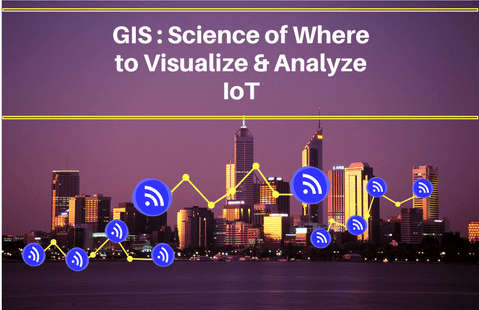
GIS as Science of Where to Visualize & Analyze your IoT

Recently I was fascinated by an infographic outlining facts and statistics about Internet of Things or IoT. It was projected IoT connections will grow to 50 billion by 2020, from about 28 billion connected devices currently. While I am not a subject matter expert in IoT, I am particularly interested to see how GIS fits into the larger scheme of IoT.

According to Gartner, IoT is the network of physical objects that contain embedded technology to communicate and interact with their internal states or the external environment. A search on Wikipedia defines IoT as the inter-networking of physical devices, vehicles (also referred to as “connected devices” and “smart devices”), buildings, and other items—embedded with electronics, software, sensors, actuators, and network connectivity that enable these objects to collect and exchange data. IoT is fueled by consumerization of IT user behavior, pervasiveness of smart devices, fast/reliable internet connectivity and advancement in computing power.

In layman term, IoT is referring to a system of smart devices that are connected and communicated with each other in internet. By and large, this real time or almost real time information exchange between/among devices, (combine with proper human and artificial intelligence) shall help promote better decision making and process optimization from individual to national security level.

Gartner also identified top 10 technologies that will enable organizations to unlock the full potential of IoT in 2017 & 2018. Among the IoT technologies that will have a very broad impact on organizations business strategy is IoT Analytics – an IoT business models that will exploit large, converged information collected by integrated “things” or “sensors” and empower users with more understanding (i.e. to understand customer footfall shopping behavior) and better decision making (i.e. to choose the best route for service delivery).

This reminds me of a favorite quote from Richard Saul Wurman, Founder of TED – “understanding precedes action”.  With so many proliferation of “things”, it is no doubt crucial for us to be able to track all these assets, collate and analyze their information feeds, understand them before taking meaningful actions to take advantage of this convergence of IoT. This is where I reckon GIS as “Science of Where” will fits in the larger scheme of IoT.

GIS or Geographical Information System allows us to capture, analyze and present our data spatially in a map. GIS allows us to make better decision by applying geography, which in essence is science of where. GIS enables us to organize our information geographically, provide insights through powerful spatial analytics, and visualize these information dynamically on our smart devices.

Modern enterprise GIS is equipped with robust data integration capability and powerful geospatial analytic that allow users to collect, use, analyze, share information products anywhere, anytime on any devices. In my opinion, GIS will enhance IoT beyond capability as “system of record” for just data storage and management into a “system of insight” and “system of engagement”. GIS will complement IoT to create a system of systems or in IoT context – system of things by allowing users to:-

  1. Track and visualize location of their IoT assets
  2. Understand relationship between different “things”
  3. Visualize and understand the trends/patterns among IoT assets
  4. Pinpoint location where and when something happened
  5. Isolate noises and reveal relevant information for better decision making

GIS will empower users of IoT to discover, use, make, share geo-information products on any devices, anywhere and anytime. Hence I am convinced GIS fits well in the overall fabric of IoT. GIS can and will complement IoT with its powerful visualization and analytic which in turn will help to address information anxiety among IoT users.

“Information anxiety is the black hole between data and knowledge, between what we understand and what we think we should understand, and it happens when information doesn’t tell us what we want or need to know.” – Richard Saul Wurman, TED Founder

Equip Our Team with Operating Capability (Not Just Latest Technology)

Give a man a fish and you feed him for a day. Teach a man how to fish and you feed him for a lifetime Chinese Proverb


Similar to the proverb above, we all know that give a man a fast boat or an expensive fishing rod wouldn’t help if teaching him to fish is not part of the package. Yet this conventional wisdom is oftentimes being ignored in technology implementations. As a result of that, many good projects were subsequently abandoned because lacked of funding allocation for continuous maintenance and training.

Sounds familiar? While future proofing our technology equipment is important but we wouldn’t able to benefit much without continuous human resource development.  Although many current practices put Transfer of Technology (ToT) in initial project implementation but this one-off initiative oftentimes become the hairline crack that eventually sink the mightiest ship. The results: we often realized too late, spearheading human operating capability is still very much an on-going battle, long after acquiring the greatest technologies.

Among the reasons that warrant this on-going efforts by setting aside annual training budget are:-

  • People movement due to job transfer, retirement or new team members on-board
  • New technology versions/releases might cause previous workflow to be obsolete or irrelevant
  • New innovations/inventions that can be embedded to enhance efficiency and save time/cost
  • Take full advantage of latest configuration/integration capabilities

Formula to ensure continuous success of GIS implementation is to ensure both technology and operating capability is updated/maintained persistently. Equipping our team with the right operating capabilities deserved constant attention of all senior executives that want to make a difference.

When I was leading Esri Malaysia team, continuously equipping my team with relevant capabilities and guide them to excel in whatever they do is one of the most rewarding effort that propelled the company into spectacles growth trajectory. A trained and competent team is always more motivated, confident and committed to undertake new challenges. I suggest all senior executives shall put utmost emphasis on up-keeping operating capability for their team in order to fully leverage and maximize their ROI on technology investments.

This writer hopes to see more organizations will allocate annual training budget to equip their team with relevant operating capabilities. How about an acid test for all: “How much have we set aside our budget for operating capability training this year?”

Disaster Response Mapping Program – Being Prepared for Unexpected

is-not-a-matter-of-if-it-is-a-matter-of-when

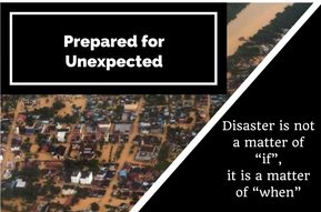
Few pictures showing flooded roads and trapped cars in East Coast caught my attention this morning. It was reported, tens of thousands of flood victims taking temporary shelter at evacuation centers amidst this unusually late monsoon session that brings heavy rainfall.

A few years ago, I met up with Chris McIntosh, head of Esri Disaster Response Program and Industry Manager for Disaster/Emergency Management based in Redlands, California. He has a lot of experience in applying advanced geospatial technology to issues faced by the public safety community.

He taught me a very valuable lesson I reckon is worth repeating and sharing. Speaking from his experience, he says “we cannot predict when emergency strikes, but we can choose to be prepared”. From information management perspective, being prepared means having ready access to information products that can be disseminated to commander, rescuers from multi-agencies with meaningful map products (both hard and softcopy) anywhere, anytime, on any devices.

This normally involved having necessary hardware, software, data, workflow and capability before disaster strikes in order to response agilely and rapidly to emergency situations. This can be in the form of drills or exercises involving multiple relevant agencies in coordinating, sharing and producing meaningful information products in the events of emergency. Post-mortem discussion to refine our shortcomings in improving coordination, data quality, workflow and technical capability surely will make us more ready when unfortunate situation strikes. We can’t really create times, but being prepared allows us to shorten our response time which in turn means more time to save valuable lives and properties.

We do not need repeated disasters to remind us of our shortcomings. Let’s be prepared before next disaster strikes again. This is not a matter of “if”, it is a matter of “when”.

Chris is absolutely right, we can’t predict the timing of unexpected, but we can choose to be prepared.

This writer hopes there will be a Disaster Response Mapping Program at national level in Malaysia that will able to render quick respond services support to those involve in disaster/emergency management.

Life Reflection: 3As – Accept, Adapt & Accomplish

muscarello

This sharing has nothing to do with GIS but might help you to excel in all your undertakings.

I had a great time taking my time off at Pangkor Island recently. I am not a good swimmer but didn’t want to miss the chance to soak in nice warm sea water off Teluk Nipah beach. While I was standing at neck deep water facing the ocean, I was pounded by countless rounds of wave. I was a bit overwhelmed but the soonest I turned my back around, the waves were no longer heading my way. In fact they became a continuous force behind of me that pushing me forward. From that moment on, I am no longer facing the force head-on but it passes me and fades way.

I have a few realizations at that defining moment. It all boils down to my perspective:-

  1. Accept: I can choose to see the wave is heading my way or it just passes me by, pushing me forward.
  2. Adapt: I can take control of the situation by adjusting my position
  3. Accomplish: I can turn the obstacle into reckoning force that gives me an extra edge to my advantage.

This writer hopes at any testing time, we will remember to accept, adapt and accomplish in all our undertakings.